
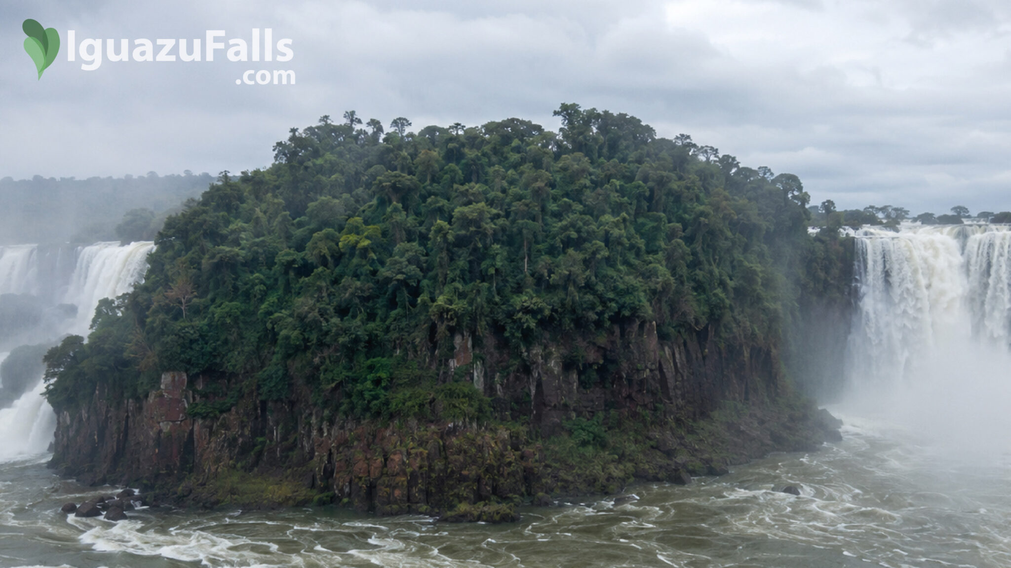
From the main viewpoints, Iguazu Falls can appear to be a single immense wall of water. In reality, it is a complex network of islands, rocky ledges, river channels and individual waterfalls distributed across almost three kilometres of the Iguazu River.
The forest-covered islands are responsible for much of Iguazu’s distinctive appearance. They divide the approaching river into separate currents, creating the many individual cascades that collectively form the waterfall system.
Some islands are large enough to support mature rainforest. Others are little more than rocky platforms covered with plants adapted to permanent humidity. A few occupy prominent positions between major waterfalls, while many remain unnamed and inaccessible.
Understanding these islands reveals the hidden geography behind one of the world’s greatest natural spectacles.
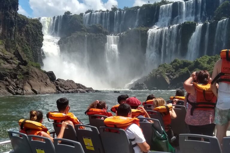
Experience the awe of Iguazu Falls on a 3-day tour from Buenos Aires. Book now for an unforgettable adventure!
From Price: USD150
The name “Iguazu Falls” describes an extensive waterfall system rather than one continuous drop.
Immediately upstream, the Iguazu River is broad and comparatively calm. As it approaches the edge of the Paraná Plateau, islands and exposed sections of resistant volcanic rock divide its flow into multiple arms.
Each channel reaches the edge at a different angle and with a different volume of water. The result is a sequence of curtains, narrow plunges, powerful cataracts and smaller falls partially concealed by vegetation.
UNESCO describes Iguazu as a series of cataracts extending across almost three kilometres and dropping approximately 80 metres. The organisation also highlights the constantly changing relationship between water, islands and subtropical forest as one of the site’s defining natural qualities.
One single amazing destination, three different countries!
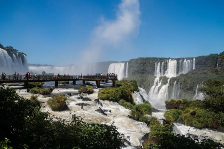
The foundations of Iguazu Falls were created by enormous volcanic events that covered this part of South America with successive lava flows millions of years ago.
When the lava cooled, it formed extensive layers of basalt. These layers did not all have exactly the same hardness or structure. Over time, water exploited fractures and weaker zones in the rock.
This produced channels, ledges, steps and ravines. The harder sections resisted erosion for longer, eventually becoming the rocky foundations of the islands visible today.
The islands are therefore not floating objects or accumulations of loose sediment. Most are resistant remnants of the basaltic platform, gradually isolated as the river carved channels around them.
Water rarely erodes a rock surface evenly. It follows cracks and weaker areas, progressively widening them.
At Iguazu, this process divided the river into numerous branches before the main drop. Some channels became major waterfalls, while others remained narrow streams between forested rock formations.
This uneven erosion explains why Iguazu is so visually complex. It is not simply a straight cliff with a river falling over it. It is an irregular, constantly evolving network of water and stone.
The width of the river, the resistant basalt and the existence of natural fractures created ideal conditions for island formation.
Instead of forcing all the water through one channel, the rocky platform spreads the flow across a large area. High points remain above the normal water level, allowing vegetation to take root.
Over long periods, these elevated areas developed soil and became forested islands. Their roots help retain organic material, while seeds arrive by wind, water, birds and other animals.
As a result, many of the islands resemble miniature sections of Atlantic Forest standing directly between the cascades.
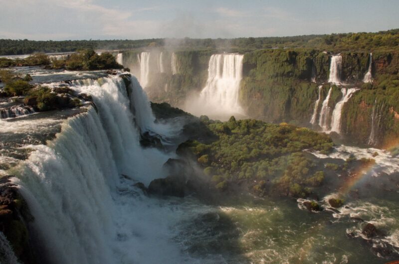
San Martín Island is the most prominent named island within the waterfall system. Located on the Argentine side, it rises between powerful branches of the Iguazu River and sits close to some of the most impressive individual falls.
The island helps separate the main river flow from the San Martín channel, contributing to the formation of Salto San Martín—one of Iguazu’s largest and most powerful waterfalls.
Historically, visitors could reach San Martín Island by small boat from the Lower Circuit. A steep stairway led to viewpoints overlooking nearby cascades.
This position provided an unusual perspective: instead of observing the waterfall system exclusively from its outer edge, visitors stood inside its geography, surrounded by channels, cliffs and falling water.
However, severe floods damaged the former infrastructure and altered the landing area. Access has consequently remained restricted for long periods.
Visitors should never assume that the island is open. Current access must be checked directly with Iguazú National Park, as river conditions, infrastructure and safety evaluations determine whether any route can operate.
Even when it cannot be visited, San Martín Island remains highly visible from several viewpoints and is fundamental to understanding the structure of the falls.
San Martín may be the most recognisable island, but it is only one part of a much larger archipelago.
Numerous smaller islands and rocky formations separate the named waterfalls. Some can be observed from the Argentine walkways, while others are easier to distinguish from the panoramic Brazilian circuit.
Many have no familiar public name. Their importance lies not in their individual identity but in their combined effect on the river.
They:
Without these islands, Iguazu would probably resemble a more continuous curtain of water. Their presence transforms it into a highly intricate collection of cascades.
Experience the awe of Iguazu Falls on a 3-day tour from Buenos Aires. Book now for an unforgettable adventure!
From Price: USD150
Many of Iguazu’s named falls exist because islands or rocky promontories separate one channel from another.
On the Argentine side, visitors encounter names such as:
Each has its own shape and water volume, but none exists in isolation. Every waterfall is part of a connected hydrological system influenced by the surrounding islands, river arms and basalt ledges.
This is one of the most powerful falls outside Devil’s Throat. Its location beside San Martín Island creates an especially dramatic combination of water, forest and exposed rock.
The name means “Two Sisters” and refers to two adjacent falls separated by vegetation and rock. They offer a clear example of how small divisions in the river produce distinct cascades.
These neighbouring waterfalls appear as a complementary pair. Their form and visibility change according to river volume and the movement of spray.
Its Spanish name means “Hidden Fall.” Vegetation and the position of San Martín Island make it difficult to see from some angles—a perfect illustration of how Iguazu’s islands reveal or conceal parts of the waterfall system.
DISCOVER A WONDERFUL PLACE TO ENJOY BIRDWATCHING. BE READY WITH YOUR BINOCULARS.

Devil’s Throat is the largest and most famous section of Iguazu Falls, but its geography differs from the more fragmented cascades downstream.
Here, a major part of the river converges into a deep horseshoe-shaped chasm. The water does not simply descend from one side: it seems to collapse inward from several directions.
Islands and river channels upstream still influence the flow, but the dominant geographical feature is the enormous canyon receiving the water.
This concentration explains Devil’s Throat’s extraordinary sound, spray and visual power. Elsewhere, islands divide the river into individual falls; here, the channels gather around one immense void.
The geography remains relatively stable on a human timescale, but its appearance can change dramatically.
When the river rises, smaller channels expand and previously separate cascades may appear to merge. Low rocks and vegetation can disappear beneath the water.
The islands seem smaller, while the waterfall front looks wider and more continuous. Spray increases and may obscure sections of the landscape.
When the river level falls, more of the basalt platform becomes visible. Individual channels, islands and rocky ledges are easier to distinguish.
Some minor cascades weaken or temporarily disappear, making the underlying geography more obvious.
This is one reason photographs of Iguazu taken at different times can look surprisingly different. The islands remain, but the river redraws the visible boundaries around them.
Iguazu’s islands exist within one of the wettest parts of the waterfall environment.
Mist rises continuously from the cascades and settles on leaves, rocks and soil. UNESCO notes that permanent spray soaks many islands and riverbanks, producing an exceptionally humid microclimate.
This environment supports dense vegetation and specialised organisms capable of tolerating constant moisture.
Mosses, ferns, bromeliads, vines and small plants grow on exposed surfaces. Larger islands support shrubs and mature trees whose roots penetrate cracks in the basalt and stabilise accumulated soil.
The result is a striking contrast: delicate vegetation survives only metres away from enormous volumes of falling water.
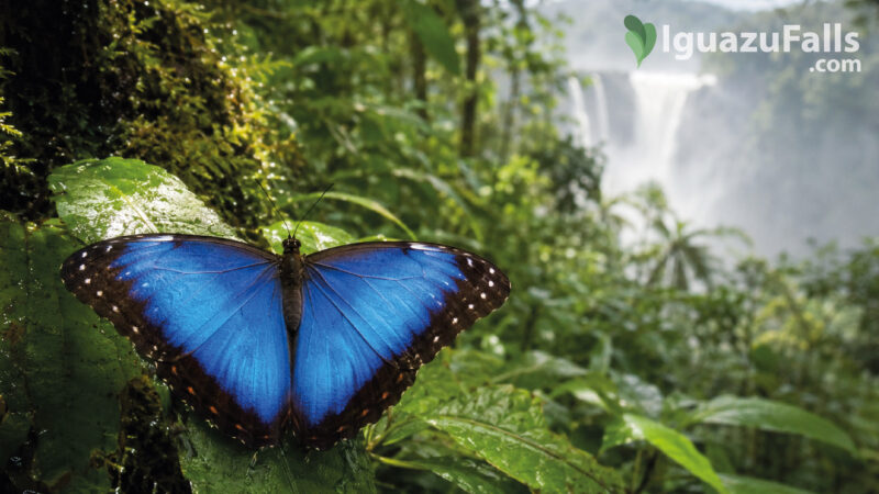
The islands are not isolated from the surrounding ecosystem. Birds can move between them easily, while some mammals and reptiles may reach larger formations when water levels and channel conditions permit.
Typical inhabitants or visitors may include:
Their isolation can provide some protection from human disturbance, but the environment is demanding. Water levels can rise quickly, currents are powerful and usable land is limited.
The Argentine circuits provide the closest experience of Iguazu’s fragmented geography.
Walkways cross river branches and lead over portions of the basalt platform. From these paths, visitors can observe water moving around trees, disappearing between islands and reappearing at the edge as separate waterfalls.
The experience is immersive because travellers often move through the landscape before seeing the final drop.
The Argentine side is particularly useful for understanding:

Explore the Brazilian side of Iguazu Falls and visit Parque das Aves in a single full-day experience.
From Price: USD95
The Brazilian side provides the clearest overall view of the system.
From across the gorge, the forested formations can be seen separating the waterfall front into individual sections. San Martín Island becomes easier to recognise, and the relationship between the numerous falls is more apparent.
The Brazilian perspective is therefore ideal for understanding scale and composition. The Argentine side places visitors within the geography; the Brazilian side allows them to read it from a distance.
Visiting both sides provides the most complete interpretation.
Most of the islands are protected, inaccessible and surrounded by dangerous currents. Visitors must never attempt to leave official walkways, approach the river independently or enter closed areas.
San Martín Island was historically the principal exception, but access has been affected by major flooding and infrastructure damage.
Even when an island appears close to a viewpoint, the surrounding water may be extremely powerful. The calm appearance of an upstream channel does not indicate that it is safe.
Only routes officially authorised and opened by the national-park authorities should be used.
Yes, although the process is usually too slow to notice during an ordinary visit.
Water enters fractures in the basalt, removes weaker material and contributes to the gradual retreat of waterfall edges. Rockfalls and floods can produce more visible changes, altering channels, viewpoints and river access.
Vegetation also changes the islands. Roots expand existing cracks, organic material creates soil and floods periodically remove or redistribute plants.
The islands are therefore part of an active landscape. They are resistant geological remnants, but they are not permanent in an absolute sense.
Experience the Best of Argentina: From the Vibrant Buenos Aires to the Stunning Ibera Wetlands and Majestic Iguazu Falls!

Travellers can understand the islands more clearly by observing the river in stages.
On the Argentine side, watch how the apparently calm river separates into smaller branches around forested areas.
Look for trees and rocky platforms between the cascades. Notice how each island redirects the current towards a different section of the cliff.
Observe the vertical structure of San Martín Island and the relationship between the upper river, basalt cliffs and lower gorge.
Step back visually and identify the forested interruptions within the waterfall front. These are the structures that turn one broad river into many individual falls.
Compare the fragmented cascades with the concentration of water entering the horseshoe-shaped chasm.
The islands of Iguazu Falls are more than scenic decoration. They are essential components of the waterfall system.
They explain why Iguazu consists of many cascades instead of one continuous drop. They support specialised plant and animal communities, create humid microhabitats and contribute to the constantly changing interaction between rainforest and river.
They also influence the visitor experience. Every panoramic opening, hidden waterfall and curtain of spray is shaped partly by the position of an island or rocky channel.

A wonderful adventure activity including kayak and trekking
From Price: USD69
There is no simple fixed number commonly used for visitors. Iguazu contains numerous permanent islands, small forested formations and exposed rocks, and their visibility changes with the river level.
San Martín Island is the best-known island within the waterfall system and occupies a prominent position beside Salto San Martín.
Access has been closed or restricted following flood damage and safety concerns. Visitors must check the current situation with the national park rather than relying on older guidebooks.
Many lie within the complex border geography of the Iguazu River. San Martín Island is Argentine territory, while the river itself forms the international boundary through much of the waterfall area.
Their foundations are primarily basalt associated with the region’s ancient lava flows.
Yes. The islands and spray-soaked vegetation provide habitat for birds, insects, amphibians, reptiles and, on larger formations, some mammals.
Low rocks and smaller formations may be completely covered and therefore appear to disappear. Major floods can also damage vegetation and alter channels, although the larger basalt islands remain visible.
The true shape of Iguazu Falls is hidden in plain sight.
What appears from a distance to be an enormous curtain is actually a three-dimensional labyrinth of basalt, forest, channels, cliffs and islands. Water separates, accelerates and reunites as it moves around these obstacles, creating the individual cascades that make Iguazu unique.
The islands are the quiet architecture behind the spectacle. The waterfalls provide the movement and sound, but the islands determine where the water travels, where the forest survives and what visitors ultimately see.

Experience the wonder of Iguazu Falls on a private 2 day tour from Buenos Aires. Easily reserve accommodations and optional activities. Book now!
From Price: USD150
Experience the awe of Iguazu Falls on a 3-day tour from Buenos Aires. Book now for an unforgettable adventure!
From Price: USD150
